DEM generation with Python
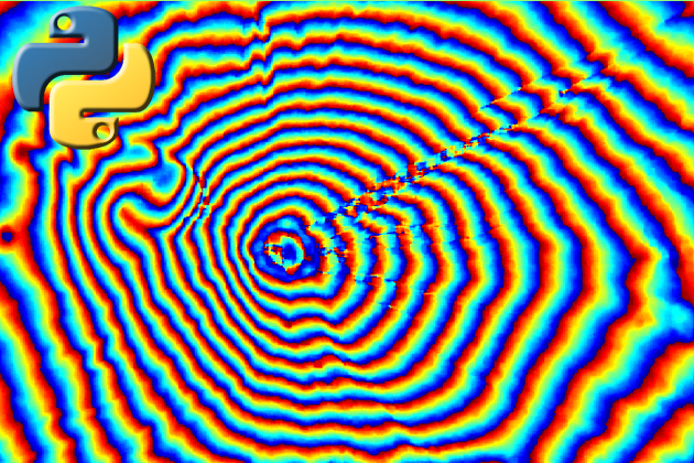
SAR interferometry is widely used for the generation of digital elevation models (DEM). The topographic information is derived by exploiting the phase differences of the coherent radar signal from 2 complex-valued SAR images, which are acquired from slightly different orbit positions. After focusing the raw SAR data, three essential steps are the main components of the standard InSAR processing:
- Co-Registration of the two complex images
- Interferogram generation and coherence estimation
- Phase unwrapping
In this tutorial the processing is conducted with the open source programming language Python. All data and instruction is included in the downloadable ZIP-File.
It’s written “with Python” but you need MATLAB to follow this tutorial.
The zip file appears be corrupted, and no file inside it. Could you please attach the correct files? Thanks in advance
The PDF contains the “DEM generation with MATLAB” – the only difference is the title page. Is there a chance to fix it?